MS Excel
Type of resources
Topics
Keywords
Contact for the resource
Provided by
Years
Formats
Representation types
Update frequencies
Scale
-
Terrestrial palaeo-environmental proxy data has been collected to examine orbital changes in wildfire activity in the Early Jurassic of the Mochras Borehole, Cardigan Bay Basin, Wales. To do this a high resolution charcoal abundance dataset was created and quantified in two size fractions, microscopic charcoal (10-125 µ) and macroscopic charcoal (>125 µ). To take potential changes in riverine influx and/or organic preservation in account on the charcoal abundance, palynofacies were analysed to document all terrestrial and marine organic particles present in the samples, and next to this, X-ray fluorescence data was gathered to assess detrital output. Mass spectrometry provided information on the carbonate and Total Organic Carbon content and bulk organic carbon isotopes. This information was used to look at changes in the lithology and the carbon cycle. Finally, clay mineralogical data was obtained to look at changes in the hydrological cycle in relation to wildfire activity. This dataset spans 951-934 mbs from the Mochras borehole, which is the time equivalent of ~350 kyr, in the Margaritatus Zone of the Upper Pliensbachian. The Mochras sediments have been deposited in the Cardigan Bay Basin, Wales. At the time of deposition, this location was positioned in the Laurasian Seaway at a paleolatitude of ~35°N. These datasets were obtained at a high resolution (10 cm) using X-ray diffraction, X-ray fluorescence, mass spectrometry and palynological preparations. This high resolution was acquired to analyse the presence of precessional orbital forcing on wildfire and the other proxy datasets. This data was collected, interpreted and analysed by Teuntje Hollaar, Claire Belcher, Stephen Hesselbo, Micha Ruhl, Jean-Franҫois Deconinck, Sarah Jane Baker and Luke Mander. The complete dataset presented in the published article file ‘Wildfire activity enhanced during phases of maximum orbital eccentricity and precessional forcing in the Early Jurassic’ has been included in this data file.
-
The data was generated from a range of laboratory experiments where a range of silicate rocks (granite, basalt, peridotite) were crushed in oxygen-free conditions, deoxygenated water added, and the generation of hydrogen gas and hydrogen peroxide followed over a week. Results were compared to rock-free controls. The data was collected to provide insight into the production of oxidants (such as hydrogen peroxide) along tectonically active regions of the subsurface, and how the oxidants might influence subsurface microbiology.
-

40Ar/39Ar ages of 37 mica and 21 hornblende from the sand-sized fraction of an iceberg-rafted debris-rich layer deposited in the Scotia Sea at IODP Site U1538 ~1.2 million years ago during the early Pleistocene.
-
The datasets include the results of microcosm experiments documenting the generation of hydrogen gas, hydrogen peroxide and dissolved iron from silicate rocks and pyrite at zero deg C after they have been 'flash heated' to different temperatures. The data is in excel format. This data is from an upcoming publication, Flash Heating Boosts the Potential for Mechanochemical Energy Sources for Subglacial Ecosystems' Stone, Jordan., Edgar, John O., Rutherford, Johnny., Gill-Olivas, Beatriz, Tranter, Martyn., Gould, Jamie A., Xavier, Cijo M. & Telling, Jon. Submitted to Frontiers in Geochemistry.
-
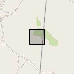
The breccia units at the Songwe Hill / Mauze complex are located at, or close to, the contact between nepheline syenite and the surrounding country rock. They are small, the largest comprising an area no more than ~125 × 125 m, and occur at the top of small hills abutting the larger, steeper, Mauze mountain. Owing to sparse outcrop, many of the available samples are float. On the weathered surface, the rocks are buff-pink in colour, with local black Mn-oxide staining. Most samples are heavily altered and composed predominantly of clay minerals, after K-feldspar, and Fe- and Mn-oxide phases. Geological Magazine (2021) 158 (11): 2025-2041. https://doi.org/10.1017/S0016756821000601
-
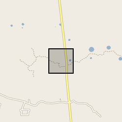
Dataset contains an interannual to sub centennial resolution record of carbonate oxygen and carbon isotopes, bulk sediment geochemistry and sedimentology from a 2.95 metre-long core (YC2) from Yaal Chac. The core was dated using a combination of radiocarbon dates and short-lived radio-isotopes. Data are presented in Metcalfe et al (2022) Quaternary Science Reviews https://doi.org/10.1016/j.quascirev.2022.107445
-
IDA272269 Methane and CO2 gas concentrations and stable isotope analyses of cutting samples from GGA05 and GGA08 boreholes of the Glasgow UKGEOS facility. Cutting samples were collected approximately every 3m depth in gas tight isojars by the BGS. Geochemical gas analyses was carried out at the Scottish Universities Environmental Research Centre (SUERC) and consisted of bulk concentration analysis using gas chromatography; followed by δ13CCH4, δ13CCO2, and δD stable isotope analyses on a methane combustion line (full methods attached). This data was collected to investigate the variability of gas fingerprints with depth within the Glasgow coal mine workings, and unmined Carboniferous coal measures. Samples and data are derived from the UK Geoenergy Observatories Programme funded by the UKRI Natural Environment Research Council and delivered by the British Geological Survey.
-

Data set is of drill fluid return, settling tank, and bore hole flush fluids sampled during the development of GGC01 seismic monitoring borehole and GGA07 and GGA08 mine water geothermal wells at the UKGEOS - Glasgow site.
-
The dataset contains details of field collection of groundwater samples with use of different water intake devices and the measurement results of gaseous compounds (methane) obtained during analytical method validation performed in order to develop a methodology of groundwater sampling for analysis of dissolved gases. The dataset is not intended to be used for any site characterisation. Sampling sites were chosen based on high probability of occurrence of measureable methane content in groundwater. Furthermore, the data will be used for formal procedure to obtain the methodology accreditation from the Polish Centre for Accreditation (PCA). The dataset was created within SECURe project (Subsurface Evaluation of CCS and Unconventional Risks) - https://www.securegeoenergy.eu/. This project has received funding from the European Union’s Horizon 2020 research and innovation programme under grant agreement No 764531
-
The dataset contains results of field measurements (temperature, pH, conductivity, redox potential, oxygen content) of groundwater and samples collection details as well as the results of laboratory analysis of the set of dissolved and gaseous parameters performed within the environmental monitoring campaign on 3 Polish shale gas sites where exploration activities including hydraulic fracturing were conducted in 2010-2016 period.
 NERC Data Catalogue Service